 Reporter Name
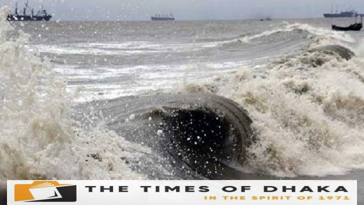

The low pressure over the Bay of Bengal has strengthened into a pronounced low pressure. Bangladesh Meteorological Department said it may become stronger and become a low pressure.
At the same time, the agency has asked fishing boats and trawlers plying in the deep sea to approach the coast with caution.
The Meteorological Department said this in a marine warning on Thursday (May 23)
It is said that the low pressure in the southwest Bay of Bengal and adjacent west-central Bay of Bengal area has moved slightly northeastward and concentrated in the form of a distinct low pressure in the west-central Bay of Bengal and adjacent southwest Bay of Bengal. It can be more concentrated
Fishing boats and trawlers operating in North Bay of Bengal and deep sea have been asked to approach the coast with caution until further notice. At the same time, they have been asked not to wander in the deep sea in the warning.
Due to various natural causes, the region of centrifugal wind or low pressure is formed in some places of the sea. Gradually this stormy area gathers energy (increasing wind speed) to become a clear low pressure, low pressure, deep depression and finally a cyclone.
According to the Meteorological Department, the clear depression is the area of gusty winds of 31 to 40 km per hour. A low pressure is a gusty area with wind speed between 41 and 50 km per hour. In case of deep depression, the wind speed is between 51 and 61 kmph.
If the wind speed is between 62 and 88 km/h in a stormy area, it is called a cyclone.
The India Meteorological Department said the pronounced low pressure may turn into a low pressure by Friday (May 24). It will then move north-east and intensify into a cyclonic storm by Saturday (May 25).
After that, it may move northward and cross the coast of Bangladesh and West Bengal as a severe cyclone on Sunday (May 26), Indian meteorologists said.
If it turns into a cyclone, it will be named ‘rimal’. This name is given by Oman. It means sand.
Escap is an organization of meteorologists from 13 countries (Bangladesh, Myanmar, India, Pakistan, Maldives, Thailand, Sri Lanka, Oman, Qatar, United Arab Emirates, Iran, Saudi Arabia and Yemen) in the Asia-Pacific region of the United Nations under the World Meteorological Organization (WMO). Gives the name of the cyclone.
Although there is a clear low pressure in the sea, there is intense heat throughout the country. Heat waves are blowing over different districts. Temperatures will rise on Thursday and the scope and intensity of the heat wave may increase, meteorologists said.
The Meteorological Department has said that rain may increase from tomorrow Friday.